Forest Restoration and Management Projects
The Wasco County Forest Collaborative brings together a diverse group of partners to plan forest management and restoration projects that span public and private lands. Since 2015, the Collaborative has partnered with the Forest Service to plan numerous projects on the Barlow Ranger District, building a strong project pipeline that contributed to two Joint Chiefs Awards and designation as a Wildfire Crisis Strategy Priority Landscape. These efforts have increased funding for fuels reduction and staffing on the Mt. Hood National Forest. Beyond federal lands, partners are restoring adjacent state and private forests and supporting homeowners in creating defensible space to reduce wildfire risk.
Hootenanny Project
The Hootenanny Project seeks to restore approximately 3000 acres of National Forest System lands in a mixed ownership landscape bordering ODFW White River Wildlife Area and private lands.
South Pen Insect and Disease Project
The South Pen Insect and Disease Project aims to reduce tree density to relieve stress on overcrowded forests and improve tree health. By thinning stands, the project will lower the risk of insect outbreaks—particularly from beetles like the western pine, mountain pine, and pine engraver—that thrive in dense, drought-stressed conditions.
Pollywog Insect and Disease Project
This project will reduce the risk of landscape level disturbance and increase forest resiliency to insect and disease. This project will treat 2,600 acres using mechanical and non-mechanical treatments.

Grasshopper Restoration Project
The Grasshopper Restoration Project is designed to enhance and restore forest diversity, reduce risks associated with high-intensity wildfires, improve conditions for wildlife and aquatic resources, and provide timber and other forest products.

Rocky Restoration Project
The Rocky Restoration Project looks to improve the health and vigor of forested stands, and improve conditions for wildlife and aquatic resources, while reducing the risk of human-caused fires on nonfederal lands.

South Five Mile Insect and Disease Project
The project will reduce the risk of landscape-level disturbance and increase forest resiliency to insect and disease. Vegetation treatments would take place on less than 3,000 acres in the eastern portion of the Barlow Ranger District.
27 Road Fuel Break
The primary purpose of this project is to reduce the risk of landscape level disturbance by establishing a linear fuel break along National Forest System (NFS) roads.

Eastside Mastication Project (2018 & 2022)
Project to mechanically thin, masticate, pile, and brush sapling plantations on the Barlow Ranger District (2018 and 2022).
Gate Insect and Disease Project
This project will reduce the risk of landscape-level disturbance and increase forest resiliency to insect and disease. Vegetation treatments are planned on approximately 3,000 acres in the southeastern portion of the Barlow Ranger District.
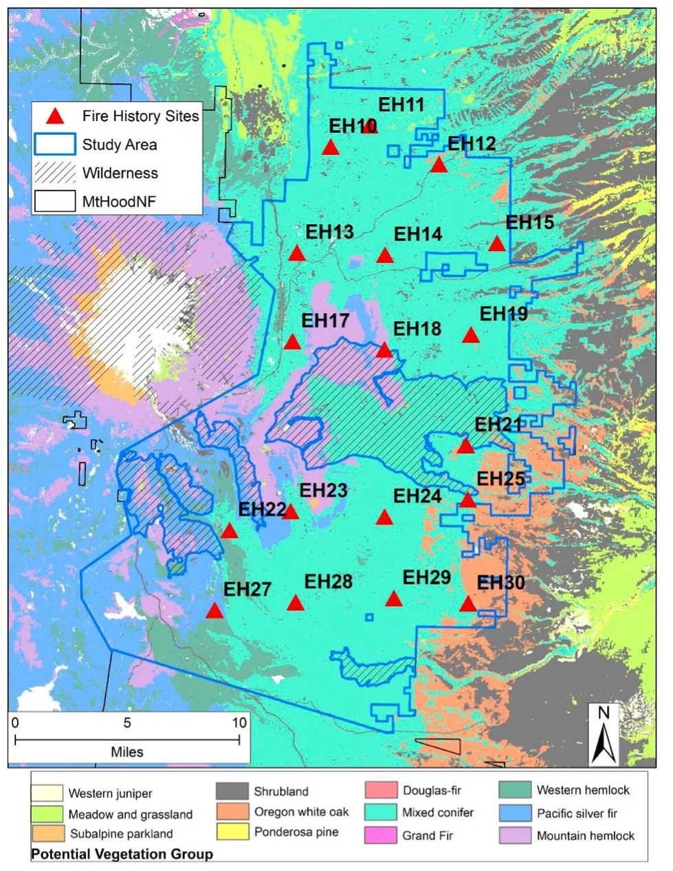
Fire History Study
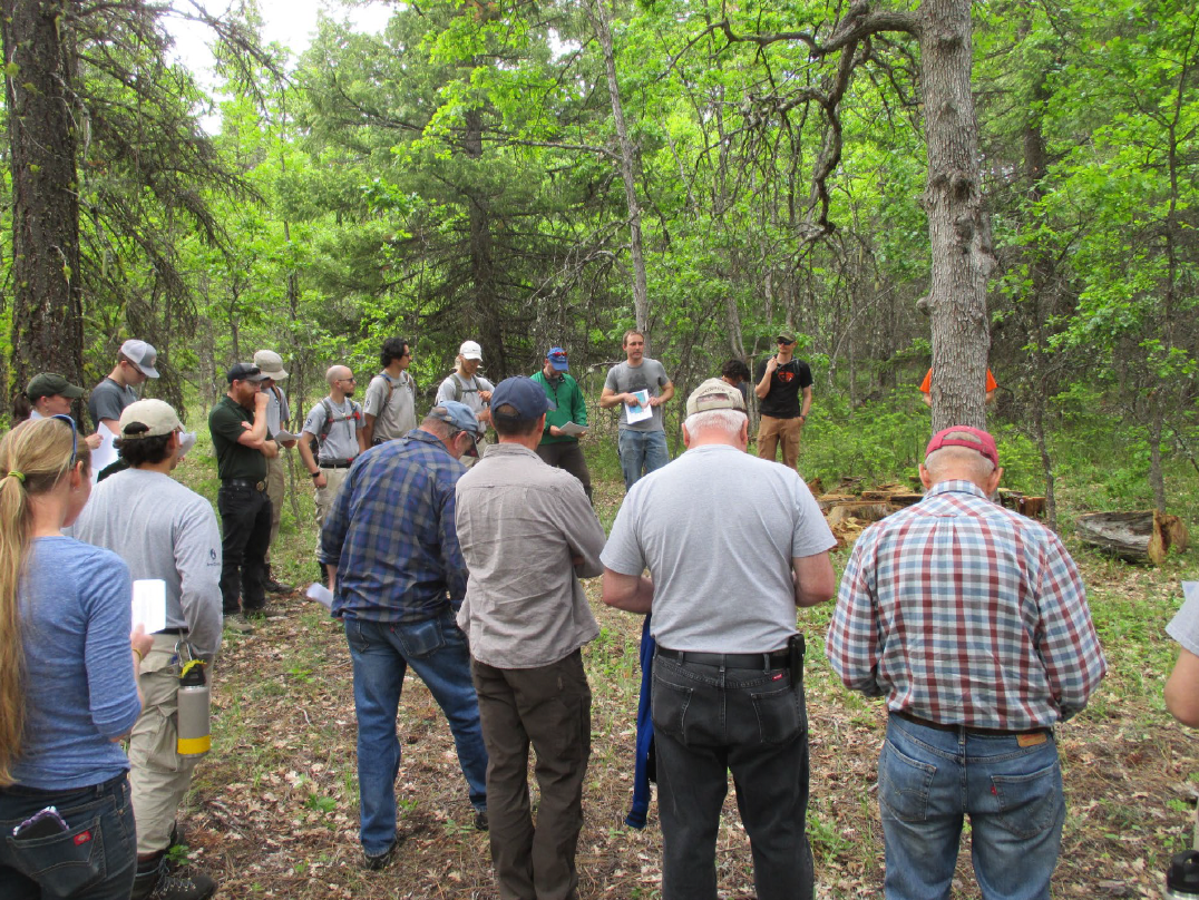
The Wasco County Forest Collaborative spent nearly two years summarizing the research findings and developing consensus-based management recommendations, memorialized in a Zones of Agreement document. You can review the Fire History Study Zones of Agreement here.
For copies of presentations and research results from Oregon State University click here.

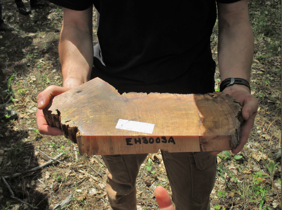
The Hood River and Wasco County Forest Collaboratives are working with researchers from Oregon State University to better understand the history of wildfires on the east side of Mt. Hood National Forest. By studying tree rings and historic records, scientists are learning how often fires used to burn in the area, what kinds of trees grew there, and how forests were shaped by both natural fires and cultural burning by Indigenous peoples.
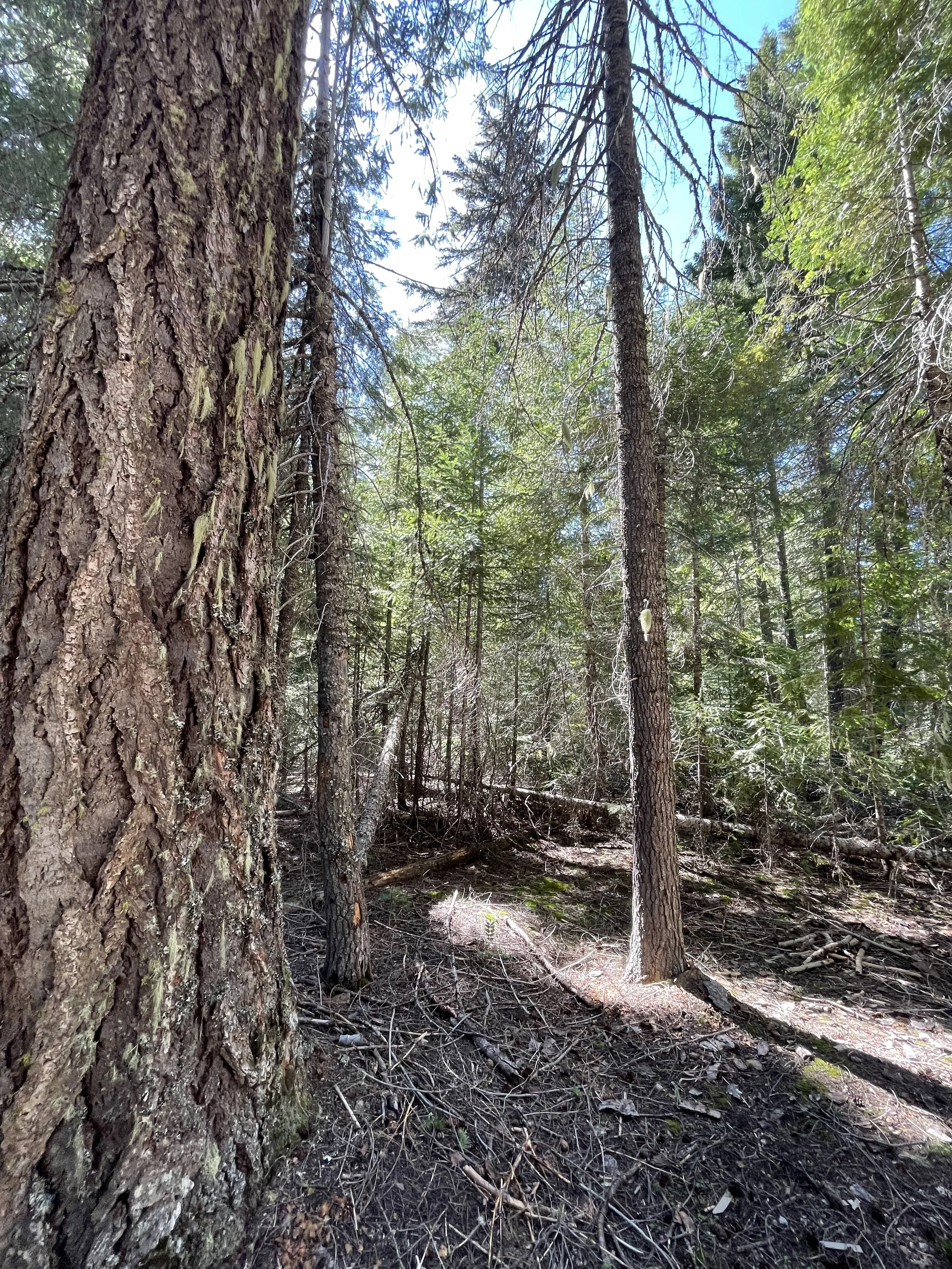
Before modern fire suppression policies were introduced, regular fires helped maintain open, healthy forests with large, fire-resistant trees. But after more than a century without fire, forests have grown denser and more vulnerable to drought, insects, disease, and large wildfires. This study looks at what forest conditions were like before Euro-American settlement and how they’ve changed since fire was excluded.
The findings will help forest managers develop science-based strategies to restore healthier, more fire-resilient forests—especially important now as we face increasing risk of drought and wildfire. This research combines fieldwork using tree ring data and historical research like maps (1859-1939) and photos (1930s) to provide a clearer picture of how forests functioned in the past and how we can better care for them today.
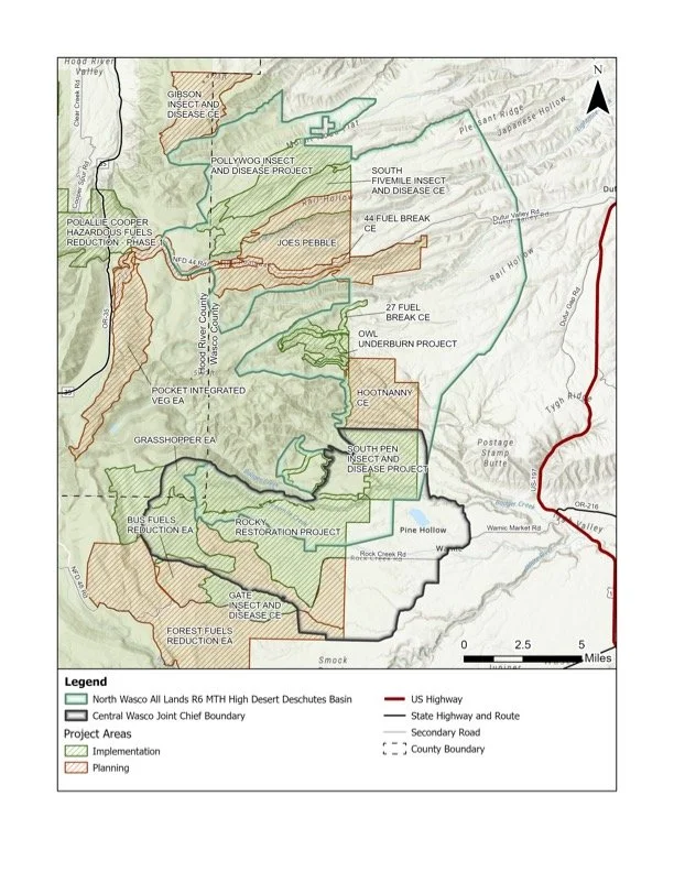
The map (left) shows the location of the fire history study sites from Phase I of the research project. Map and photos compliments of Oregon State University.